The most beautiful hike in St. Moritz in Switzerland – from Fuorcla Surlej to Pontresina
If going for a hike that is a few hours long, make sure it is a spectacular one. Then, even the longest trail is rewarded with views along the way. Recently I have been lucky and I find some really unique trails and even the weather seemed to be on my side. My last trip to the Swiss Grisons was definitely one of the stunning natural wonders.
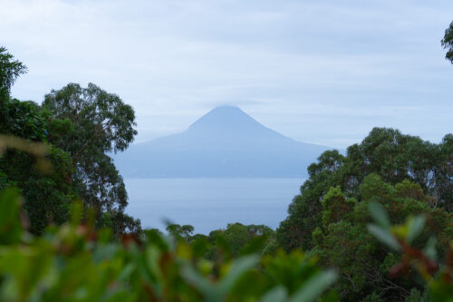
The panoramic views of Piz Bernina and Piz Roseg from Fuorcla Surlej provide a front-row seat for the Alpine spectacle. The trail from Fuorcla Surlej to Pontresina has it all – snow-capped peaks, beautiful flowery meadows, and the dense Val Roseg forest. This is by far my favorite hike around St. Moritz.
The trail starts at the Corvatsch middle station in Murtel and right at the beginning offers wonderful views of the plateau of the upper Engadine lakes. From Murtel it goes up to Fuorcla Surlej (Surlej Pass) from where you can enjoy views of Piz Bernina, Piz Roseg, and the Tschierva Glacier. In the background, impressive glaciers spread over the slopes of the Stella Massif. Stunning!
Behind the pass, the trail turns southwest and leads us high above the west side of Val Roseg through meadows overgrown with wild flowers. With each step, the view of the Bernina Range gets better and better. Snow-capped peaks pop in front of your eyes, including Piz Stella and Piz Gluschaint. Piz Bernina and Piz Roseg rise above the valley. The blue glacial waters of Lake Lej da Vadret sparkle in the sun.
You can spend one day on a trail or you can choose a longer version with an overnight stay at the Coaz Hut. The Coaz Hut offers a wonderful view of the massive Roseg and Stella glaciers falling down the valley front wall. For most tourists, the one-day hike that includes visiting the hut and going down to Pontresina is too long. However, you can also visit the cabin on the way back from Murtel or visit it halfway from Val Roseg to Pontresina.
Make sure that there is nice weather on the day when you plan to go for a hike. The trail is steep and narrow and it is not suitable for bad weather.
Hike from the beginning of the trail to Fuorcla Surlej
Distance from the beginning of the trail: 4,8 km (both ways)
Highest point: 2755 m above sea level
Elevation gain: 99,6 m above sea level
In Surlej, take the Corvatsch cable car to the Murtel middle station (2699 m/8.9 m). From the town of Murtel, there is a wonderful view of the plateau of the Upper Engadine Lakes. To the west, Piz d’Emmat Dadaint, Piz Lagrev, Piz Polaschin, and the Piz Julier massif on Lake Silvaplanna and Lake Segl, located along the valley.
In Murtel, follow the hiking signs to Fuorcla Surlej (1 hour), Chamanna Coaz (Coaz Hut) (3 hours), and Val Roseg (2 hours 15 minutes). The trail goes south-east, gently descending through an undulating landscape of rocky meadows along the northern slopes of Piz Murtel. You will see the Fuorcla Surlej (Surlej Pass) on the eastern side of the ridge. The peak of Piz Tschierva and Piz Boval rise above it.
For about 800 meters, the trail goes up the moraine of the Corvatsch glacier and crosses several small streams that carry melted water from the glacier. From here, there is a view of the Corvatsch mountain station on a small summit overlooking the Corvatsch Glacier. Then the trail goes north and ascends towards the Fuorcla Surlej Pass. On this stretch, you can enjoy beautiful views of the peaks rising along the western side of the Upper Engadin valley.
From Fuorcla Surlej, at an altitude of almost 2500 meters, there are wonderful views of Piz Bernina (4049 m) and Piz Roseg (3937 m) above the eastern side of Val Roseg. The Tschierva Glacier cascades down the western side of the peaks. The peaks of Piz Stella and Piz Gluschaint, towering over the valley, are covered with Stella and Roseg glaciers.
There is also the Berghaus Fuorcla Surlej restaurant here, where you can eat a simple lunch (but with a breathtaking view) and my absolute favorite photographic place – a small lake in which the mountains reflect.
Fuorcla Surlej to the viewpoint
Distance from the beginning of the trail: 6,4 km (one way)
Height: approx. 2655 m
Elevation gain: 234 m
When you are done admiring the views (I’m warning you – it may take a long time – I got stuck for 1.5 hours), keep following the trail up the west side of Val Roseg. At an altitude of about 2.7 km, there is a fork. The trail to the left (northeast) heads towards Pontresina. The trail to the right heads towards Coaz Hut, crosses the meadows, revealing more and more beautiful views of high peaks and glaciers. After crossing the stream, the trail turns south, goes up the hill, and then descends moderately steeply.
Soon you will cross another small stream underneath beautiful waterfalls cascading down the rocky ledges above the trail, and then the traverse begins. After 4 km, it turns left and then goes down the slope along the northern side of the stream for 160 m to the trail crossing. The trail branches to the right to Coaz Hut, which crosses the stream.
Behind the trail crossing, the trail turns southwest and then south, leading through meadows with an amazing view of the peaks that form the glacier front wall of the valley, including Piz Stella and Piz Gluschaint.
Here you will have to decide whether you want to continue your hike to Coaz Hut or go back through the Roseg Valley.
Hike to Coaz Hut
If you decide on a longer option and stay overnight in Coaz Hut, you must continue your hike. As the trail reaches the valley and, it curves southeast, passing through rocky meadows, and not that long after that it reaches Coaz Hut (2610 m). The hut offers amazing views of the Roseg and Stella glaciers. From the north, there are views over the Val Roseg valley. You will find more information about accommodation in Coaz Hut HERE.
Viewpoint to Pontresina
Distance from the beginning of the trail: 20 km (one way)
Highest point: 1805 m above sea level
Elevation gain: 878 m above sea level
To go back through Val Roseg, you need to turn around and follow the first exit to Pontresina at the eight kilometer. This section is approx. 500 m long and follows a steep path, then crosses a wooden bridge over a stream. At the trail crossing, right after you cross the bridge, you take the trail branching towards Alp Ota, Roseg, and Puntraschigna (Pontresina). The trail back to Pontresina guarantees great views of the peaks surrounding the valley.
At the bottom of the valley, you pass a trail crossing with a trail that ascends south along the valley floor towards Coaz Hut. Our trail goes northeast, on the west side of Val Roseg towards Roseg and Puntraschigna. On the right side of the valley, you will see the calm Ova da Roseg (Roseg River).
You pass the Roseggletscher Hotel. Behind the hotel, there is a wide path branching towards Puntraschigna (1 hour 45 minutes). Then we cross the bridge over the Ova da Roseg (Roseg River) on the eastern side of the valley. Our trail runs for a short time along a dirt road attended by pedestrians, horse carriages, and bicycles.
When you reach a 19 km long asphalt road, turn left (west) and walk 400 meters to Pontresina train station. Pontresina is on the other side of the Flax River on the north side of Val Bernina. The total distance of the hike is almost 20 km.
All tourist guides say that this hike takes 4-5 hours. However, this is an assumption that you will walk at the same, fast speed, without any breaks, without lunch at Fuorcla Surlej (and it’s worth it!) and without taking time-consuming photos. This hike took me nearly 9 hours, but not only did I took my time, but I also took hundreds of photos, so if you are like me – you will probably spend an entire day on the trail. And it’s worth it. Don’t rush. Sit down on one of the meadows and admire the views of the snow-capped peaks.
*** *** I visited Switzerland as part of collaboration with Switzerland Tourism Board who supported me in all my crazy travel ideas.
If you like me post and find it helpful I would appreciate if you buy me a coffee and support my work. Thank you so much! :)
Welcome on my blog about traveling, active lifestyle and chasing all the crazy dreams. I have been on 6 continents and in more than 100 countries so far, but I still have so much to explore :)
Welcome on my blog about traveling, active lifestyle and chasing all the crazy dreams. I have been on 6 continents and in more than 100 countries so far, but I still have so much to explore :)