Interlaken and Augstmatthorn trail – the most awaited hike in Switzerland
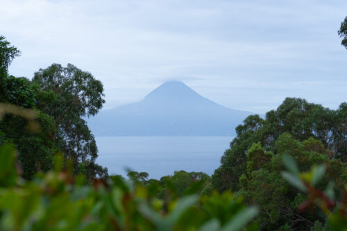
My first day in Switzerland started already at full speed. Three hours of sleep and early wake up at 4 AM to catch the sunrise in the mountains. Interlaken looks like it has been plunged into darkness and silence when I’m walking its streets before dawn. Apparently, nobody else got such a dumb idea to get up so early.But my goal is the Augstmatthorn – a 16 km long, red trail, sometimes so steep that your only thought is to turn back. Only up to the moment when you realize that walking down is even worse. So you push on, cursing your ideas of hiking at dawn. Leg pain is somehow soothed by the panoramic view over the Breinz Lake, which accompanies you all the time on the right. It reminds me the fiords in New Zealand, even better, because in New Zealand it was constantly raining and here I have the perfect weather. Everywhere in the Internet it was written that this trail takes you about 6 hours. Judging by the bypassing Swiss (often 70+ of age!), practically running uphill, I would risk saying that it could take even less. But I don’t want to run, I want to stop, take photos, savor these views and stretch this moment until it lasts for the eternity. I missed the fresh air, the mountains and the feeling of communing with the nature alone…
Augstmatthorn is one of the most spectacular peaks along the Hardergrat Ridge. It’s famous not only for its gorgeous views but also for the Ibex colony, for which this place is home.
Techcial details on the Augstmatthorn treck
Distance: The route, counting from Harder Kulm to Augstmatthorn and then to Habkern, stretches for 16 km. Most hikers catch a bus in Habkern and they return to where they started.
Climb time: An average hike from Harder Kulm to Augstmatthorn and then to Habkern, lasts about 5-6 hours. This is the information you will find on official Swiss websites and all the blogs but let me tell you the truth. My experiences taught me never to trust the Swiss count of how long the hike would take. The Swiss don’t walk the mountains – they run them and they seem to be androids who never get tired. The fact that they can cover this route in such exhausting pace (for them it’s, of course, just a walk) doesn’t mean that an average tourist would be able to do the same. I think that I never managed to close the trail in Switzerland within the supposed time. And I have to say I’m quite fit ;) On the other hand, this is an average time for constant movement but the reality is that you take breaks for snacks, admiring the landscapes and taking pictures (in the Switzerland: tons of them J). It took me 10 hours to finish this trail (with multiple stops, photo sessions and droning).
Difficulty: Two routes interweave in this trail – a white one and a red one. Walking the whole trail requires good stamina and physical condition. There are a lot of steep stages and the route itself zigzags on the mountainsides. The sum of climb amounts to 1100 m.
How to reach Augstmatthorn Trailhead (Harder Kulum)
The route starts in Harder Kulm, a popular viewpoint and a restaurant in Interlaken region. There are two ways to get there. The fastest, and the easiest one, is to take a cable car. To check the timetable and prices of the Harder Kulm Funicular click HERE. However, it departs for the first time at 9:10 AM (then every 30 minutes), so it makes it impossible to catch a sunrise in the mountains (and it’s worth it!).
There’s also a second option, including waking up in the early morning, so just walking from Interlaken to Harder. I did so, starting at 4 AM. I won’t lie, it’s a huge challenge, because combined with a 16-km-long hike to Augstmatthorn, this day will surely be long and exhausting. Route entrance in Interlaken is very well marked and is located next to the cable car station. From that point you have to take the white-red route to Harder Kulm. Get ready for an incredibly steep beginning (750 m slope) and a 4 km long climb. One thing is sure: this introduction will chase off any sleepiness.
Unfortunately, when you reach Harder Kulm you can’t expect any breakfast or coffee, because the restaurant opens at 9 AM anyway. But instead you would be able to admire how the day wakes up in the mountains. The further stages towards Augstmatthorn are marked with yellow signs, then red and white. As it usually is in Switzerland, everything is clearly marked, so you will always know, which direction you should follow.
My experiences during Harder Kulm - Augstmatthorn hiking
I entered the route a bit after the sunrise. The first 5-6 kilometers were leading me with a steady inclination through the forest, through which occasionally the “Big Three” of the region – Eiger, Monch and Jungfrau have shown. Because I already climbed for a few long hours, I started to lose patience, waiting for the spectacular views for which I had to cut my sleeping time. I guess that I have never waited so impatiently to see, what was hidden on every next kilometer.
And finally I was rewarded, because when I came out of the forest, I saw that the real route begins in this point. And it started with splendor, because almost immediately, on my right side, emerged crystal-clear, azure Lake of Brienz. I haven’t seen such an uncanny contrast between blue water, surrounding green hills and snow-capped peaks in the background for a very long time! Summer hikes in the Switzerland do have this unique magic, as the colors are so full, everything feels fresh, while the air is filled with freedom and adventure. My camera jumped instantly right in my hands but I admit that after a short frenzy I put it away to savor the moment. The nature once again showed me that it’s worth to dedicate some effort, train and sleep shorter just to be able to reach beautiful places on my own feet.
From that point the ridge looks like a very thin line drawn with a pencil but when you finally reach it, it turns out that it’s much wider than described in the guides. There are no dangerous slopes, it’s not steep. However, I wouldn’t recommend hiking it during rain or in windy conditions.
The views on the both sides of the ridge, Hardergrat on the west and Brienzergrat on the north-east, really take your breath away. The ridge itself is not a straight line, as you might expect, it’s more like a row of peaks connected with each other by a rough wall, which quite definitely divides Brienzersee from the Lombach Valley.
After reaching the most awaited peak, Siggiture (2084 m) and admiring the view on one of the two lakes on both sides – Brienzersee and Thunersee on the west, I felt incredibly thankful that I was able to experience this Swiss beauty. Then the hike was really easy but on the last stage a really strong gale appeared, making me almost run. After 3 kilometers I reached the road to Lombochalp, where you can find a parking lot and a small restaurant. Check in advance, when the last bus departs from there, otherwise you might be forced to walk a long way. I didn’t catch the bus but I managed to talk to the restaurant owners, who helped me organize a private mean of transport. After 30 minutes a small bus arrived and not only me but also a couple of others, soaked-through tourists, lucked upon a ride home. For a moment I was the hero of the day :)
If you’re not sure, whether you can walk the whole trail, you can attack it from the other side, that is park in Lombochalp, walk only 3 kilometers to the peak and go back. A lot of people do so, usually to watch the sunset and take pictures, giving up the 16 kilometers hike.
I hope that I succeeded in making you love this place as much as I did, because I truly think that it’s one of the most spectacular landscapes in the whole Switzerland.
If you like me post and find it helpful I would appreciate if you buy me a coffee and support my work. Thank you so much! :)
Welcome on my blog about traveling, active lifestyle and chasing all the crazy dreams. I have been on 6 continents and in more than 100 countries so far, but I still have so much to explore :)
Welcome on my blog about traveling, active lifestyle and chasing all the crazy dreams. I have been on 6 continents and in more than 100 countries so far, but I still have so much to explore :)